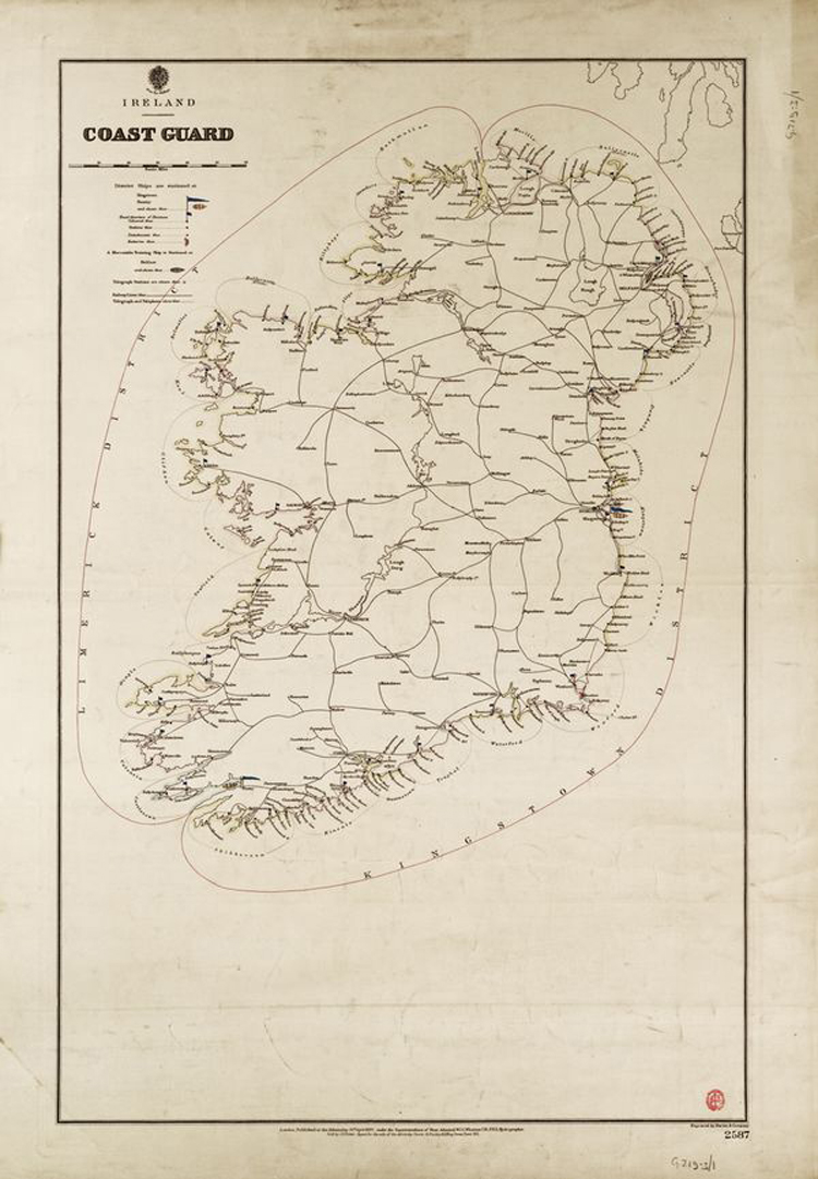
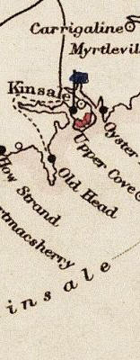
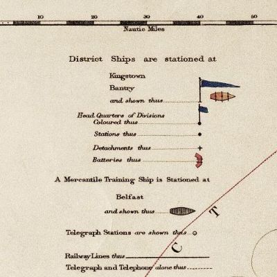
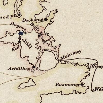
Ireland Coastguard Map of 1897
Ireland Coastguard Map of 1897
This map is reproduced here with the kind permission of the National Maritime Museum (UK) | ||||||||||||
Tweet

 Posted by Tony
on April 29 2007
Posted by Tony
on April 29 2007
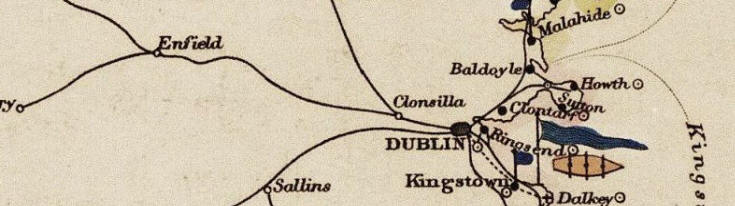
Ireland Coastguard Map of 1897
This map is reproduced here with the kind permission of the National Maritime Museum (UK) | ||||||||||||
Posted by Tony
on April 29 2007


 Henry Bray, Chief Officer, Gr...[6247] Greencastle, Donegal, Ireland[4090] Torr Head coastguards, 1930s....[12186] Michael Burns ID425[3910] Sidney Sparks family photo ci...[9034] MIKEL222 Grelennub FrancesNag Cathygog utaletruln Thomas Griffiths[5048] Naming of Preventive Stations...[1393] Movement of Coastguards[2056] Coastguard stations[4789] Coastguard station Co. Cork[3316] Loss of life in Irish shipwrecks[12600] Painting of Coastguard Stations.[29222] albert medals.[8913] Accommodation in Roundstone 1872[34659] SHIPWRECK: Brig: Nelson 27/1...[16137] The Irish Sword[2,129] George Coles Steele Service R...[1,944] Randal Hurley Service Record[2,059] John Cashman Service Record[2,440] Henry Grintons Family Tree[4,117] My 3xGreat Grandfather, Joseph ... Hi, Thomas Clark is my Great Gr... John was my great grandfather. ... This was my Great Grandfather. ... I'm looking for information on ... The Coastguard Cutter 2.27[156353] The Coastguard Cutter 2.26[198153] The Coastguard Cutter 2.25[120907] The Coastguard Cutter 2.24[295456] The Coastguard Cutter 2.23[170727] Irish Coastguard Records at Kew[118845] Crookhaven Restoration[87141] Snippets[85205] Coastguard Marriage Records[75323] County list of CG Stations. 1900[70248] Rescue Rocket[25962] William Davie[21384] Coastguard Cottages Moville C...[20210] Coastguard Houses Ardglass[19706] Portaferry[19703] Admiralty Coastguard Station ...[16568] National Archives Census Records[9633] British Genealogy[7743] Marinas.com[5440] www.rootsweb.com/~nirdow2[5225]
| Timothy Gribble Census 1901 Ref: 95/2 |
Powered by PHP-Fusion copyright © 2002 - 2026 by Nick Jones.
Released as free software without warranties under GNU Affero GPL v3.
white theme by HobbyMan 43,706,057 unique visits
